Pyramid Hill Hike
Map
Description
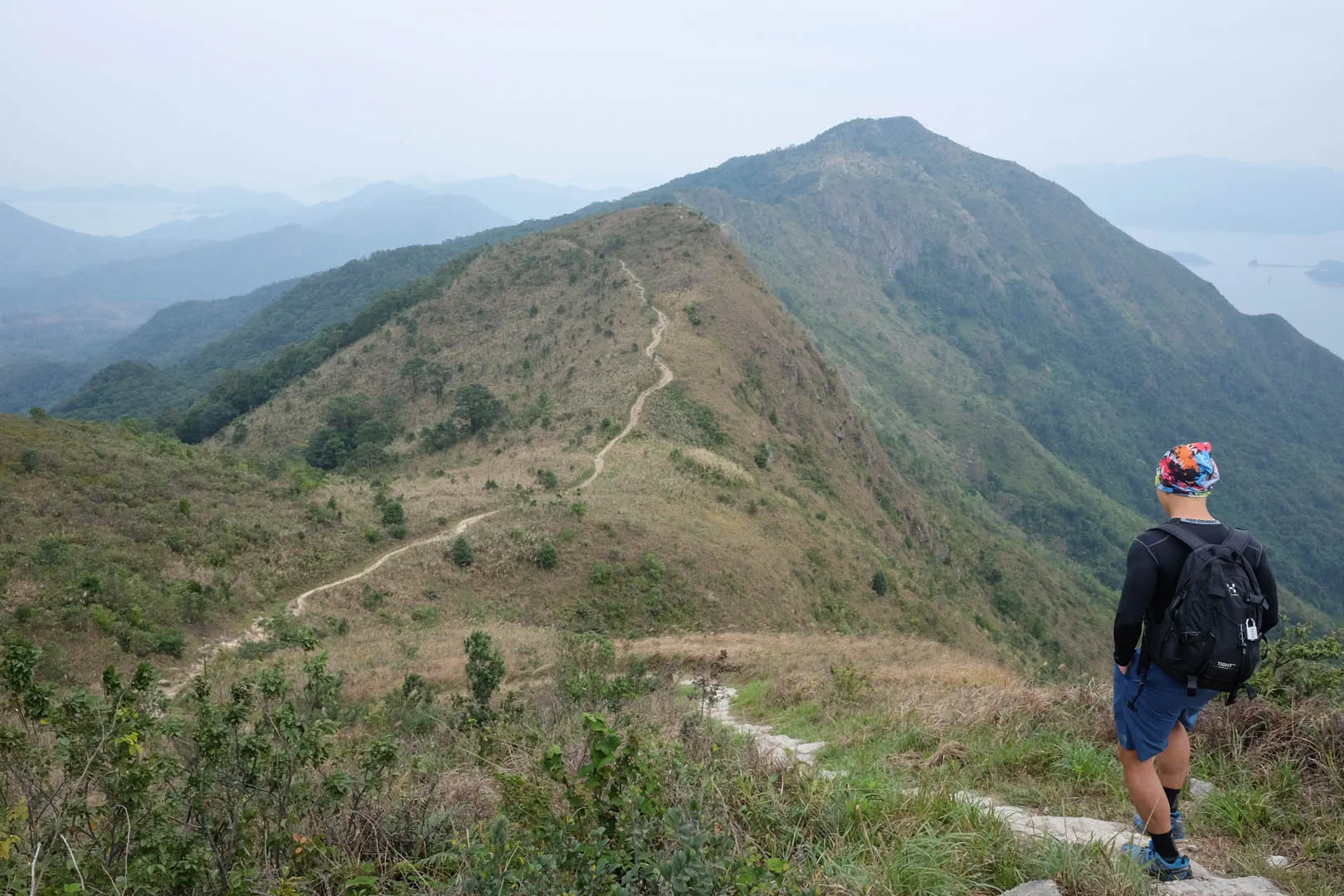
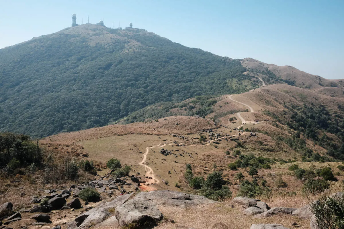
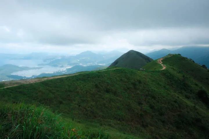
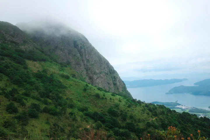
Maclehose Trail Section 4 is one of the hardest sections. The hike is 12.7km and takes around 5 hours to complete. It begins at Kei Ling Ha, where Sai Kung West Country Park meets Ma On Shan Country Park. The trail goes through several climbs through Ma On Shan, the highest point being 540m above sea level along the ridges near Pyramid Hill. At the plateau, enjoy panoramic views of the Sai Kung Islands to the East, and Ma On Shan, Sha Tin, and Tai Po to the West. The trail ends at Tai Lo Shan in the middle of the mountains with no public transport nearby. Make sure to plan ahead and account for extra time and water to get down the mountains. The walk down to Ho Chung, Siu Lek Yuen, or Diamond Hill takes an additional 1-2 hours.
Hike elevation
The initial one-hour climb from Kei Ling Ha is moderate. The walk starts at 160m above sea level and reaches 220m before gradually plateauing around 200-220m. The trail ascends to 540m near Ma On Shan and drops to 400m past the ridge and at Ngong Ping viewing point. The trail continues along the ridges between 320m and 480m, and ends at 420m elevation at Tate’s Cairn (Tai Lo Shan).

Trail surface
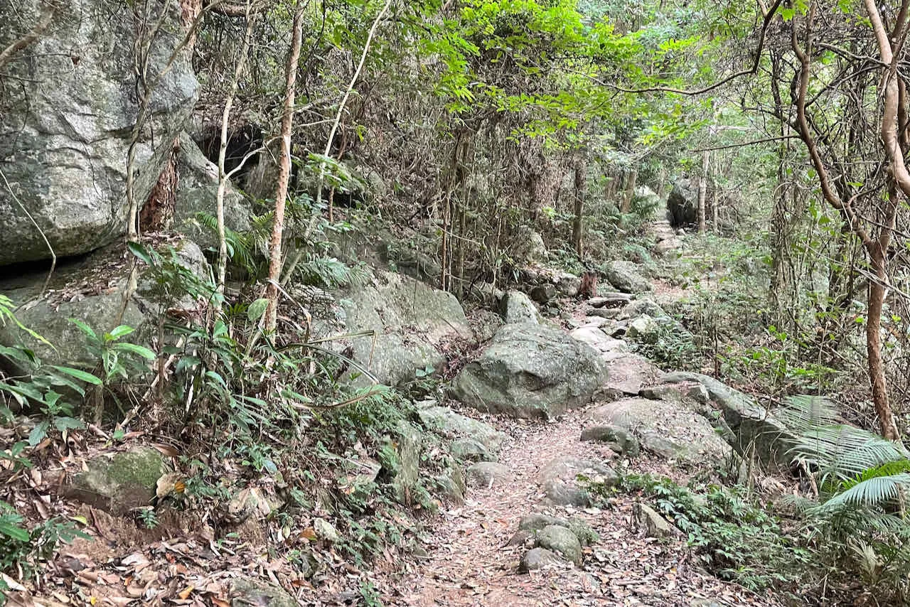
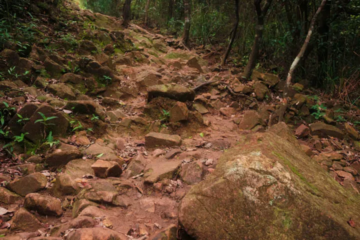
The first hour of the initial ascent and descent is entirely flat concrete. As the trail makes a left into a dirt path, the surface becomes a lot more comfortable with a clay and dirt mix. The ascents and descents of the trail are a split between flat rock steps and highly irregular rock paths.
The path at the plateau is made of dirt and small rocks. Walking along the ridges is extremely comfortable and satisfying.
There are small sections of the hike facing north, where there is lack of sunshine and wind, that are extremely damp and wet, even on a dry day. This, combined with the rocky steps, make it slippery and difficult to walk.
Transport
Going to the starting point
From Sai Kung: Take bus 299 or 99 from Sai Kung Town Center and get off at Shui Long Wo bus stop.
From Sha Tin: Take bus 299 from Sha Tin bus terminus towards Sai Kung and get off at Shui Long Wo bus stop.
Leaving the finishing point
⚠ The trail ends at Tai Lo Shan in the middle of the mountains with no public transport nearby. Make sure to plan ahead and account for extra time and water to get down the mountains. The walk down to Ho Chung, Siu Lek Yuen, or Diamond Hill takes an additional 1-2 hours.