Tai Mo Shan Hike
Map
Description
Tai Mo Shan is Hong Kong’s highest mountain, with a peak elevation of 957m. Its nickname in Chinese is 大霧山—Big Mist Mountain (which is also pronounced Tai Mo Shan) because it’s always covered by clouds (especially during March and April). Tai Mo Shan is also one of the only places in Hong Kong that falls below freezing point (0°C) during winter. Every year, frost chasers walk up the mountain in hope of finding frost and ice.
The mountain stretches through the middle of New Territories, with views of surrounding towns like Tai Po, West New Territories, and even the Shen Zhen’s cityscape on a clear day.
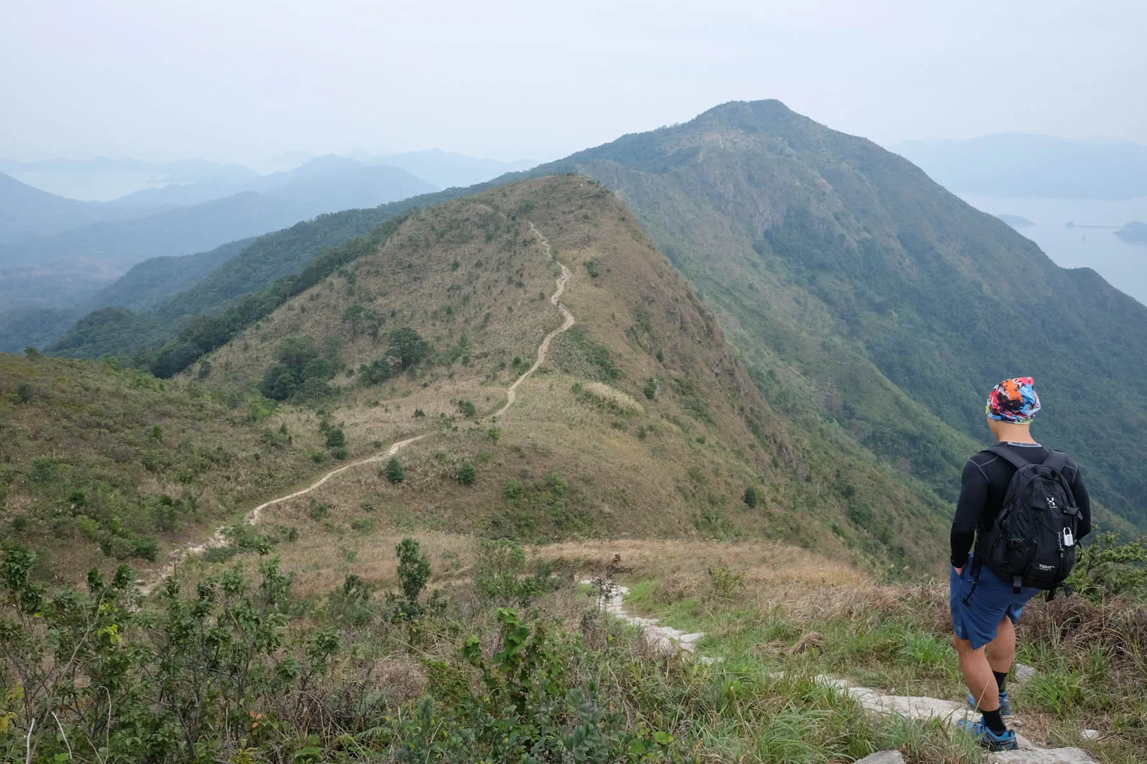
The trail itself is not that difficult compared to others like Lantau Peak and Sunset Peak, due to the gradual ascent and car-road S-curved descent.
⚠ The starting point of this hike is around 1-2 hours walk away from the closest public transport at San Uk Ka (a 5-minute minibus ride from Tai Po Market MTR station).

Hike elevation
The hike begins at San Uk Ka, located in South of Tai Po and approximately 120m above sea level. The 1-2 hour walk up Wilson Trail Section 7 to the starting point of Maclehose Trail Section 8 ascends to 400m moderately.
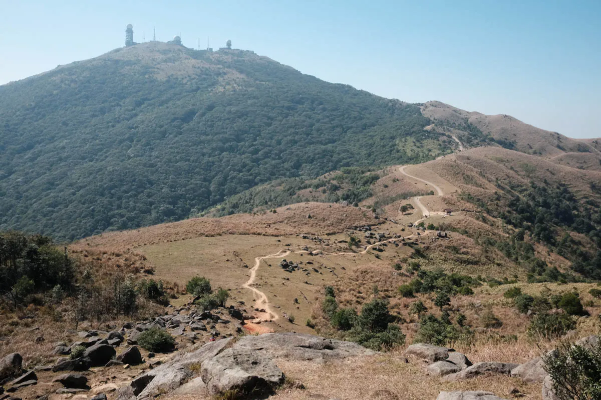
From there, the hike up to Tai Mo Shan ascends very gradually. There are several plateaus throughout the hiking trail — wonderful spots to stop for lunch.
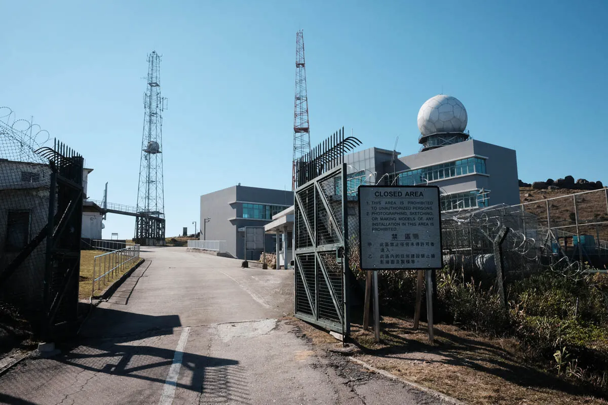
The actual highest point of Tai Mo Shan (and Hong Kong) isn’t actually accessible to the public. At the top of the mountain sits the weather radar station, with signs that clearly mark “CLOSED AREA.” The highest point of the hike comes quite close to it though, approximately 920m above sea level.
The road down the southwest side of the mountain (accessible by permitted cars) winds down to compensate the steepness. The trail comes to an end at 480m elevation. The overall descent is quite easy.
Trail surface
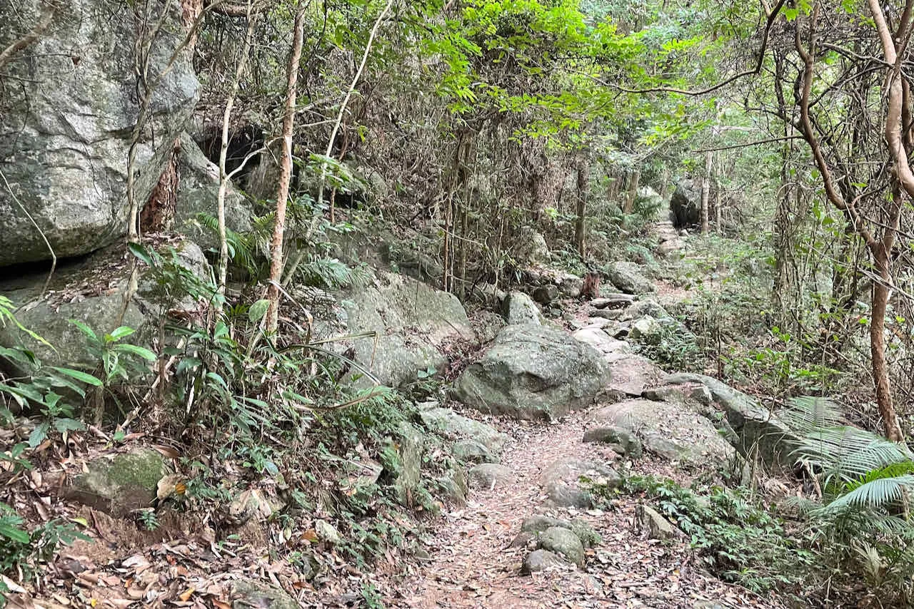
The overall hiking trail is wide, making it easy to pass other hikers. The majority of the trail’s surface is dirt with big and flat rocks.
From the last section of the ascent onwards, all the way to the end of the trail, the path is asphalt—a car road accessible to vehicles with permits. The paved path makes it easy to walk.
Transport
Going to the starting point
Take minibus 23K/23S from Tai Po Market station and get off at San Uk Ka. From there, walk Wilson Trail Section 7 towards Lead Mine Pass (1-2 hours).
Leaving the finishing point
Take bus 15 to Tseun Wan.